


Adequacy of desktop fauna assessments without a site visit
Recently, we received advice from the Department of Environment and Conservation (DEC) that a desktop fauna assessment based on the data in NatureMap without a site visit was adequate for the DEC to assess potential impacts on the vertebrate fauna for an exploration area. The project is in an area that has been poorly surveyed and the vertebrate fauna is poorly known.
Is a desktop assessment without a site visit adequate? The relevant documents to assess the potential adequacy of the desktop assessment are:
- EPA (2002) Terrestrial Biological Surveys as an Element of Biodiversity Position Statement No. 3;
- EPA (2004) Guidance for the Assessment of Environmental Factors Terrestrial Fauna Surveys for Environmental Impact Assessment in Western Australia; and
- EPA and DEC (2010) Technical Guide – Terrestrial Vertebrate Fauna Surveys for Environmental Impact Assessment.
Position Statement No 3 indicates that for all bioregions in Western Australia a desktop assessment should be accompanied by a reconnaissance survey. This reconnaissance survey is to:
- verify the desktop survey;
- delineate key flora and fauna values present in the area and the potential sensitivity to impact; and
- undertake broad scale vegetation and vegetation condition mapping based on selected sites rather than regular gridding.
Guidance Statement No 56 adds nothing to what Position Statement No 3 says. The Technical Guide indicates that a Level 1 survey consists of a desktop study and basic ground-truthing through a reconnaissance survey. The reconnaissance survey should verify the accuracy of the desktop study, so that the consultant can delineate and characterise the fauna and faunal assemblages present in the project area, and identify potential impacts. This involves a site visit by suitably qualified personnel to provide habitat descriptions and habitat maps of the project area and undertake selective, low intensity sampling of the fauna and faunal assemblages. The information collected will help determine if a Level 2 survey will be required and/or whether it will target a particular species or group.
The DEC advice is clearly not in accordance with the requirements described above.
The other question that might be asked is how would the desktop assessment be used? The Native Vegetation Clearing Principles and the Position Statement No 3 indicate what the DEC and EPA can expect of proponents if they are intending to clear vegetation or disturb vertebrate fauna. Of the 10 Native Vegetation Clearing Principles the following five are potentially assessed based on the fauna data provided:
- It comprises a high level of biological diversity.
- It comprises the whole or a part of, or is necessary for the maintenance of, a significant habitat for fauna indigenous to Western Australia.
- It comprises the whole or a part of, or is necessary for the maintenance of, a threatened ecological community.
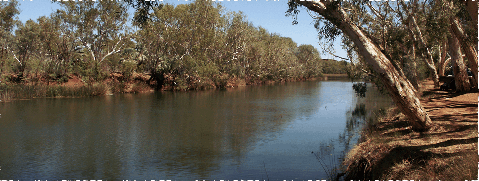
- It is growing in, or in association with, an environment associated with a watercourses or wetland.
- The clearing of the vegetation is likely to have an impact on the environmental values of any adjacent or nearby conservation area.
A desktop assessment based on data in NatureMap is likely to produce an incomplete species list in a poorly surveyed area. It will probably not include the presence of threatened species if they are indeed present and will tell you nothing of the relative abundance of the various species or the fauna assemblage structure. A NatureMap desktop search is therefore likely to only provide a vague indication of the level of biodiversity, and provide little information on the importance of the area for indigenous Western Australian fauna. It would be impossible to tell whether the area contains a wetland or watercourse without a high quality aerial photograph or a site visit.
Position Statement No. 3 indicates that the EPA requires sufficient information to address both biodiversity conservation and ecological functional values within the context of the type of proposal being considered and the relevant EPA objectives for the protection of the environment. Given that NatureMap is likely to produce an incomplete fauna species list and little or no useful information about the assemblage structure, it would be difficult to argue that a desktop assessment without a site visit would provide the necessary data to enable government assessors to make a reasonable judgement on potential impacts based on the EPAs expectations.
It is our observation that as time goes on, government assessors are adhering less to the requirements laid out in Position Statement No. 3 and Guidance Statement No. 56. Environmental Consultants quickly pick up on this change in standard and respond by providing lower quality assessments. The industry has now arrived at the situation where an environmental consultant that tenders for work based on what is outlined in Position Statement No. 3 and Guidance Statement No. 56 is likely to overstate what is expected by the government assessors and is unlikely to provide a competitive tender.
More importantly, how adequate is the assessment of potential impacts on the fauna, if the author(s) of the fauna assessment report have not visited the site and have little or no appreciation of the fauna assemblage structure.
References
Environmental Protection Authority. 2002. Terrestrial Biological Surveys as an Element of Biodiversity Protection: Position Statement No. 3.
Environment Protection Authority, Perth. Environmental Protection Authority. 2004. Guidance for the Assessment of Environmental Factors. Terrestrial Fauna Surveys for Environmental Impact Assessment in Western Australia No. 56. Perth.
Environmental Protection Authority and Department of Environment and Conservation (Eds Hyder, B. M., Dell, J. and Cowan, M.A.),. 2010. Technical Guide – Terrestrial Vertebrate Fauna Surveys for Environmental Impact Assessment. Environmental Protection Authority, Perth.
