


Do we need a comprehensive public fauna survey database?

In 2005, Prof. Philip Withers (UWA) and Dr Graham Thompson, via the Royal Society of Western Australia, received a $99,000 grant to develop a custom written software package for a vertebrate fauna survey database. The intent of this grant and LotteryWest (the grant provider) was that the data were to be made publicly available. In short, we were tasked to prepare a custom written software package that would enable all fauna data records collected under either a Regulation 15 and 17 Licence issued by the Department of Parks and Wildlife (DPaW) under the Wildlife Conservation Act to be electronically collected, stored and made available to the public. Prior to this software being available, returns were paper based and simply stored in Department files with very limited access to largely unusable information. This task was completed and the software handed to the Department of Conservation and Land Management (now Parks and Wildlife) and is the Fauna Survey Database on the DPaW website . Neither Prof. Withers, myself, nor the many other people that contributed to the development of this database were paid; in fact, it cost each individual a lot of time and effort contributing this public good.
We conducted a workshop during the preparation of this software to obtained broad support from the science and consulting community for what we were doing. Mr Bernard Bowen, the then Chair of the Environmental Protection Authority (EPA), opened that workshop and launched the draft ‘General Requirements for Terrestrial Biological Surveys for Environmental Impact Assessment in Western Australia. Preliminary Position Statement No. 3 (Environmental Protection Authority 2000)’ on the same day and participated is some of the workshop discussions. In his presentation to the workshop, Bowen (2002) stated:
“Government should be providing ready access to an integrated database, but it should also be setting the standards for biological surveys. Some of this is set out in a Position Paper released today by the Environmental Protection Authority entitled ‘Terrestrial Biological Surveys as an Element of Biodiversity Protection’. One of the passages from that Position Statement reads ‘ The EPA intends to encourage the coordinated development of a state-wide database for EPA related biological surveys in consultation with environmental practitioners and Western Australian natural resource management agencies and authorities “
Privately, Mr Bowen indicated that the EPA strongly supported the release of all fauna survey data that were used in the preparation of EIAs, and he indicated that a statement along those lines would be incorporated into the final Position Statement on vertebrate fauna surveys when it was released. True to his word, one of the eight overarching principles for environmental impact assessment of diversity (Environmental Protection Authority 2002 p. 5) reads:
“The EPA expects that terrestrial biological surveys will be made publicly available and will contribute to the bank of data available for the particular region, to aid the overall biodiversity understanding and assessment by facilitating transfer into State biological databases.” (p5)
Upon receipt of the operational custom written software program, the Department of Conservation and Land Management re-engaged the programmer to tweak the software to limit public access to the data. This unnecessary restriction on accessing these data is still in place.
In addition to Fauna Survey Database, we have NatureMap which is provided by the Department of Parks and Wildlife. This database is useful, in that it contains data from various sources, there is a component on ‘themes’ that includes information on five threatened species in the Pilbara, Great Western Woodlands data and vegetation surveys, etc. However, again the Department has placed restrictions on accessing these data (e.g. a maximum of 500 specimen records, a search area limited to a 40km radius, etc) that significantly reduces the usefulness of this database. In addition, there is limited contextual information for fauna records. For example, the data are not referenced against a particular report, so the detection effort or survey protocols and fauna habitat data are not available.
In the past, the Western Australian Museum provided online access to its collection database (i.e. FaunaBase), but this ceased some years ago and access to these data are now obtained via Ozcam.
We now have access to Atlas of Living Australia which is a collection of data provided by a range of other agencies [e.g. Western Australian Museum (WAM), Department of Agriculture and Food (DAFWA), Birds Australia and individuals]. This is a particularly useful database, however, its records only remain up-to-date if the sourcing institutions update the records. So for example, if there is a taxonomic change and the Western Australian Museum records are updated, it requires the Western Australian Museum to send the updated records to the Atlas. Some of this updating is not occurring and the veracity of the data are the responsibility of the user, not of the Atlas.
However, these databases do not contain the fauna survey records from the many thousands of fauna surveys undertaken by researchers and environmental consultants, thus the original reason for developing the Fauna Survey Database software.
Prior to the last State government election the Liberal Party promised to ‘provide $8 million to develop a publicly available online biodiversity, water and cultural heritage database and virtual library to assist the resources sector in protecting the State’s unique biodiversity, natural environment and cultural history by capturing and aggregating historical and new environmental and heritage information and knowledge (ref). This $8m has never been appropriated, however, the Department of Mines and Petroleum (DMP) has undertaken a small scale prototype that is yet to be made public. I’m advised by DMP that this revised small scale prototype will be placed on the Department’s website at some stage in the future. From discussions with DMP staff there is no obvious link between the DMP database and NatureMap and Fauna Survey database, nor the proposed biodiversity database that the Western Australian Biodiversity Science Institute is planning to implement.
In 2013, the DPaW conducted six very useful workshops on threatened vertebrate species in the Pilbara using environmental offset funds. The issue of the need for a comprehensive fauna survey database that was a repository for all of the available fauna survey data was discussed at most of these workshops and often deemed a high priority project.
Again in 2014, DPaW in co-operation with the Great Victoria Desert Biodiversity Trust conducted three very useful workshops on threatened species, and again the need to have a comprehensive fauna survey database was raised and many workshop participants thought it was a high priority project.
The Western Australian Biodiversity Science Institute (WABSI) now exists. Among other things it is proposed that the Institute will provide a framework for improved biodiversity knowledge management. The WABSI brochure states: ‘A comprehensive atlas of the State’s biological resources can be delivered through a more coordinated and focused effort across agencies and industry’. So true, but who will do it and who will fund it? The brochure goes on to state ‘Whilst considerable goodwill exists amongst stakeholders to better coordinate the State’s biodiversity knowledge, some significant barriers remain. These include competitive tensions between research providers that compete for funding or the protection of intellectual property and data that may have a commercial or strategic advantage. Similar competitive tension exists within industry as a result of the commercial advantage that a robust knowledge of biodiversity within a region can have in securing government approvals for projects. In addition, a number of technical issues relating to privacy and variation in the quality and format of data will need to be resolved’.
So do we need another layer of bureaucracy (i.e. WABSI) to do what the Department of Parks and Wildlife should be doing and the Liberal government committed the Department of Mines and Petroleum to do during the life of this Parliament?
The 2015-16 WA State Budget indicates the Department of Parks and Wildlife was appropriated approximately $206m for the delivery of services, and one of the stated outcomes of this appropriation is that ‘The State’s native plants and animals are conserved and habitat, ecosystem and landscape-scale conservation are based on best practice science’ (ref). So there is an obvious capacity and scope within the budget framework for DPaW to fund a comprehensive fauna survey database, all that is lacking is the Department’s willingness to give this project a sufficiently high enough priority within its $206m budget for it to be properly funded.
In 2015, the Western Australian government (Department of Premier and Cabinet 2015) released its ‘Whole of Government Open Data Policy’. This policy states that data are considered open when:
- released and available for the general public (not for exclusive use);
- easily discoverable;
- in formats that are modifiable, non-proprietary and machine-readable;
- licensed to enable reuse and redistribution; and
- available at no cost to users.
This policy has a focus on the provision of ‘raw data’, and indicates that government data should be open and available by default, with Departments and government agencies being required to argue a case why data should not be made available to the public, and for these data to be up-to-date as possible and the information made available when requested in a timely manner. The government is to be congratulated for this significant step forward. It now behoves the various government Departments and agencies to get on board and free up and make available data that to-date has not been readily available for a variety of reasons.
So what else can and should be done? Some companies appear to be reluctant to share the fauna survey data they have collected, often under the misguided view that it will provide them with some competitive advantage. However, most of these same companies on the flip side indicate a strong willingness to protect the State’s biodiversity, yet fail to do the small things that could make a significant contribution. The EPA appears to have walked away from its commitment to require proponents of developments seeking an environmental approval via the EPA or one of the other agencies that operate under the Environmental Protection Act [e.g. DMP and Department of Environment Regulation, (DER)] to make public the fauna survey data that they have used and cited in the preparation of an impact assessment or Native Vegetation Clearing Permit application. A restatement and implementation of Mr Bowen’s commitment would be a significant step forward. However, the best approach would be to mandate this requirement in a change to the Environment Protection Act or is included in the WA Biodiversity Conservation Bill 2015 that is currently before the WA Parliament.
DPaW could, with minor amendments and almost no cost, tweak the software in Fauna Survey Database and NatureMap to significantly increase access and free up data.
So do you think a comprehensive fauna survey database is important and necessary, and of high enough priority that an appropriate State government agency should allocate the necessary resources and get on with it. Or do we continue to discuss this issue at future workshops and conferences or wait for an agency that is external to government (e.g. WABSI) to do what our government should be doing?

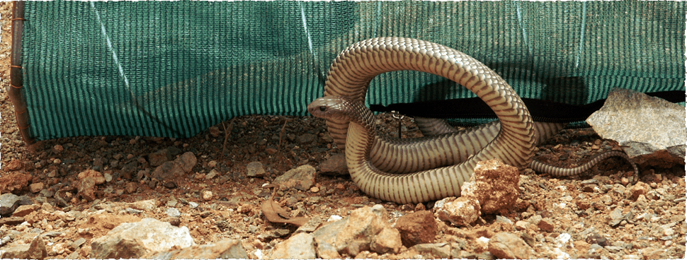
Images – top: Paraplocephalus atriceps – Lake Cronin Snake (found ~250km east of the known distribution); bottom: Moloch horridus – Thorny Devil (juvenile on the back of an adult to shown size comparison)
References:
Bowen, B. 2002. Opening of the workshop on terrestrial fauna surveys databases. Journal of the Royal Society of Western Australia 85:113.
Department of Premier and Cabinet. 2015. The Western Australian Whole of Government Open Data Policy. Perth.
Environmental Protection Authority. 2000. General Requirements for Terrestrial Biological Surveys for Environmental Impact Assessment in Western Australia. Preliminary Position Statement No. 3. Environmental Protection Authority, Perth.
Environmental Protection Authority. 2002. Terrestrial Biological Surveys as an Element of Biodiversity Protection Position Statement No. 3. Perth.

Comments
One Response to “Do we need a comprehensive public fauna survey database?”
Got something to say?
I really resonate with this article. My passion is spot wildlife and I do scour the internet for data about where fauna has been seen. To date I have had mixed results in using sources like NatureMap, ALA & GBIF to try and find where certain animals have been observed to help me target their habitats. I know there must be data out there from wider fauna surveys but I haven’t had much luck in making sense of it.
An example is I have been trying to observe Rakali in the Swan/Canning River – the data that WWF/DPaW collected on Rakali surveys was entered but I haven’t been able to pinpoint where observations were made.
I understand some of this data may be sensitive and possibly misused – especially for endangered wildlife and fauna that is commercially valuable to wildlife smugglers.
I enter my observations into the citizen science website iNaturalist which in turns feeds into ALA, GBIF and also I recently found NatureMap!
Cheers Ry