


Sampling for fauna surveys undertaken to support an EIA
In almost all cases a fauna survey undertaken to support an EIA will sample the vertebrate fauna and the data will be used to infer characteristics about the population. Bias associated with the sampling procedure should therefore be minimised as it will directly affect inferences about the population. Two approaches can be adopted in sampling major habitat types:
- a proportional allocation; or
- an optimal allocation.
In a proportional allocation, the number of sampling units (e.g. sampling sites or trap lines) is proportional to the area of each of the major habitat types (i.e. larger fauna habitats have more sampling sites than smaller habitats). In an optimal allocation, the number of sampling units is based on obtaining an accurate estimate of the population in each of the habitat types (e.g. the number of sampling units is determined by the percentage of the species in that habitat that the surveyor wished to record). This invariably requires that a minimum quantity of data is collected for each major fauna habitat type. The latter of these two is the preferred option for most generic fauna surveys undertaken to support EIAs as this:
- enables the surveyor to compare survey data among habitat types (i.e. each habitat type has the same survey effort); and
- is often more cost effective (e.g. the majority of resources are not committed to large fauna habitats at the expense of being informed about the fauna in all major habitat types).
The approach adopted should be modified if an objective is to detect a conservation significant species in a particular habitat type that is known to be rare or difficult to trap.
If the objective is to estimate species and population densities, then a stratified randomly selected sample should be used, if it is to provide a species list and an indication of relative densities then an adaptive sampling approach should be adopted.
Random sampling vs. adaptive sampling
Random sampling is a procedure where every sampling unit has an equal chance of being selected. Adaptive sampling is a procedure where sampling units are selected based upon the values and location of variables of interest during the survey.
To be able to infer from a survey sample to the general area or population, survey sites should be randomly located throughout each of the major habitat types (Bibby 2005, Gregory et al. 2005). However, such a design may not maximise the opportunity to detect all species in a habitat and may add appreciably to the travelling time and therefore the cost (Keast 1984). It could also result in high fauna mortality, a loss of useful data [e.g. bird observations in the early morning; (Keast 1984)] and may result in additional environmental damage. Environmental consultants are often forced to trade-off the benefits of randomly selected survey sites with the use of an adaptive approach because of cost and time pressures to maximise other objectives (e.g. developing a complete species list).
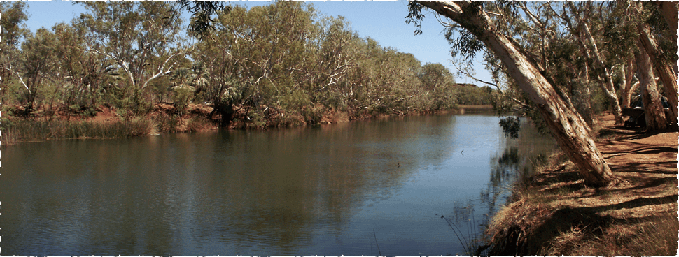
Prior knowledge of the relationship between habitat type and fauna assemblages may indicate surveying in some microhabitats or at a particular time is more conducive and cost-effective in determining species richness and providing an estimate of relative abundance (Bibby 2005). For example, birds are often more easily detected early in the morning because of their increased movement and vocalisations at this time. Similarly, vegetated creek lines through barren landscapes are likely to contain most of the avifauna that are found in the adjacent areas, plus those species that are largely confined to the more densely treed areas (Keast 1984). Focusing the survey effort in these times or areas can provide a better species list and an indication of the relative abundance in areas likely to contain the highest densities. Similarly, locating funnel and pit traps in the shade of trees may provide a higher level of protection to trapped animals than placing these same traps in open areas, and this may or may not influence what is caught, but it will reduce deaths due to solar radiation.
Where fauna habitats are defined a priori and therefore fauna assessment sites are stratified based on this categorisation (Gregory et al. 2005), then the data are probably biased based on the surveyor’s perceptions of what defines a habitat for the various species (Thompson and Thompson 2008). The use of adaptive / convenience sampling then needs to be recognised as a limitation, as many statistical tests, modelling and estimating procedures assume that the data have been collected in a random fashion. If estimates of species richness and relative abundance are deemed important for either the entire assemblage or for a particular (conservation significant) species, then a modified form of a stratified random sample is probably appropriate, such that sampling units are randomly located within predefined habitat types (i.e. the entire area has been stratified into habitat types; Gregory et al. 2005).
Sampling units
The nature, size and location of sampling units can influence the extent to which the data collected are representative of the population. Sampling units can be defined as a single trap or a group of traps, or for birds a transect or search area. Greenwood and Robinson (2006) suggested that sampling units are best kept compact so they have short edges, but ‘strips’ may be used where appropriate (e.g. avian and aquatic surveys).
When working within defined budgets (money and time) there is a trade-off between increasing the number of sampling units which increases statistical power or increasing the sampling effort for each site to increase the precision and accuracy of the estimates within each sampling unit (Smith et al. 1995, Sims et al. 2006). Sampling sites are often ‘grouped’ to reduce travel time and costs.
An excellent basic discussion of the principles of sampling for generic surveys is provided by Greenwood and Robinson (2006) and for avian surveys by Bibby et al. (2007). We could find nothing in the literature that provided advice about the optimum size of terrestrial trapping program sampling unit or avian survey sampling unit (Recher 1988, Bibby et al. 2007). However, to facilitate comparison among sampling units, it is desirable that the size and survey effort at various sites are the same. This will mean that all transects are of uniform length, and the number of traps and the period that they are open are uniform across all sites.
Our experience is that vertebrate abundance will vary markedly from site to site, sometimes for no obvious reason. A strictly random sampling approach will often provide samples containing few individuals in many arid and semi-arid areas of Western Australia. So in the context of collecting sufficient data in a cost effective manner to enable assessors to make informed judgements about potential impacts of a development on the fauna, an ‘adaptive sampling’ approach that concentrates the effort on those areas that are likely to yield more information than if sites were selected at random is suggested. As a general principle, data should be collected at a fine resolution in either space or time, and always in a homogenous habitat type (e.g. not across habitat types), as these data can always be aggregated and this approach provides greater analytical possibilities (Bibby 2005). Below are the suggested smallest sampling units for terrestrial and avian and surveys.
Sampling units for terrestrial trapping surveys
Our smallest sampling unit in terrestrial fauna surveys is an individual trap often located on a drift fence. We cluster traps for efficiency. Our choice of sampling unit size for generic terrestrial fauna trapping programs is based on four considerations:
- cost-effectiveness and convenience;
- minimising trap deaths;
- availability and dimensions of survey materials (e.g. length of a roll of drift fence flywire); and
- the potential number of individuals likely to be caught during a trapping period.
We most commonly use four 30m lengths of flywire drift fence (i.e. one roll of flywire) for each sampling site. Each of our survey sites has four drift fences and contains 12 20L PVC buckets, 12 150mm by 500mm deep PVC pipes as pit traps, 12 pair of funnel traps, 12 aluminium box traps and, if wire cage traps are used, then one wire cage trap is set adjacent to each drift fence (Figure 1). Consistency in this configuration enables comparison among surveys, but it is modified if there is an obvious reason for a variation (e.g. additional cage traps are required to sample for Isoodon obesulus and Dasyurus geoffroii). We endeavour to have four and if possible five replicate sites per major habitat type, but this is altered based on the availability of funds and how we define habitat types. For example, if habitat types are not obvious and are more of a continuum rather than being relatively discrete, then the number of sites will be increased. Surveys are generally conducted for seven days and repeated to capture data for two seasons depending on the survey objectives.
 |
|
Figure 1. Typical layout for a single trapping site, with horizontal dimension not shown to scale |
Sampling units for avian surveys
The sampling unit used for birds is a wandering transect over 2ha area in densely vegetated habitat or 3ha area in sparsely vegetated habitat.
References
Bibby, C. J. 2005. Bird diversity survey methods. Pages 1-15 in D. R. Sutherland, I. Newton, and R. E. Green, editors. Bird Ecology and Conservation. Oxford University Press, Oxford.
Bibby, C. J., N. D. Burgess, D. A. Hill, and S. H. Mustoe. 2007. Bird Census Techniques. Academic Press, Amsterdam.
Greenwood, J. J. D. and R. A. Robinson. 2006. Principles of sampling.in W. J. Sutherland, editor. Ecological Census Techniques. Cambridge University Press, Cambridge.
Gregory, R. D., D. W. Gibbons, and P. F. Donald. 2005. Bird Census and survey techniques. Pages 17-55 in W. J. Sutherland, T. R. New, and R. E. Green, editors. Bird Ecology and Conservation. Oxford University Press, Oxford.
Keast, A. 1984. Assessment of community composition and species richness in contrasting habitats. in S. J. J. F. Davies, editor. Methods of Censusing Birds in Australia. Department of Conservation and Environment, Perth.
Recher, H. F. 1988. Counting terrestrial birds: use and application of census procedures in Australia. Australian Zoological Review 1:25-45.
Sims, M., S. Wanless, M. P. Harris, P. I. Mitchell, and D. A. Elston. 2006. Evaluating the power of monitoring plot designs for detecting long-term trends in the numbers of common guillemots. Journal of Applied Ecology 43:537-546.
Smith, W. P., D. J. Twedt, R. J. Cooper, D. A. Wiedenfeld, P. B. Hamel, and R. P. Ford. 1995. Sample size and allocation of effort in point count sampling of birds in Bottomland hardwood forests. Pages 7-17 in C. J. Ralph, J. R. Sauer, and S. Droege, editors. Monitoring Bird Populations by Point Counts. US Department of Agriculture, Forest Service, Pacific Southwest Research Station, Albany, CA.
Thompson, G. G. and S. A. Thompson. 2008. Spatial variability in terrestrial fauna surveys; a case study from the goldfields of Western Australia. Journal of the Royal Society of Western Australia 91:219-228.

Comments
One Response to “Sampling for fauna surveys undertaken to support an EIA”
Got something to say?
It seems like there are many different approaches that can be taken to survey land. Figuring out the ecological value of the land is an undertaking in and of itself, but it would definitely be intimidating to have to make the decision of how to go about it. In the end, though, it seems that if companies are taking the time to figure it out, it’s a lot better than not even trying!